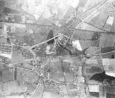
Air photo (below) from around 1946, a virtual map of the area showing the Mosley Common colliery to the north and the village before any significant post-war house building.
Air photo (below) from around 1972, showing the East Lancashire Road (bottom left), and Chaddock Lane running into the village. The site around Yates’s mill is prominent in the centre of the photograph, and the Standfield hosuing estate is being built in the top left corner. To the top right you can see the new St Andrew’s school under construction.
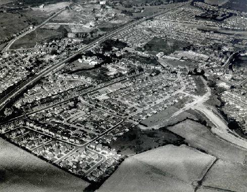
Air photo (below) from around 1972, taken facing north-east. The East Lancashire Road runs across the the top left of the photograph, and you can see Mosley Common colliery to the north. The fields in the bottom right of the photo have now been built over – you can see the construction of Vicars Hall Gardens and Brookfield Drive.
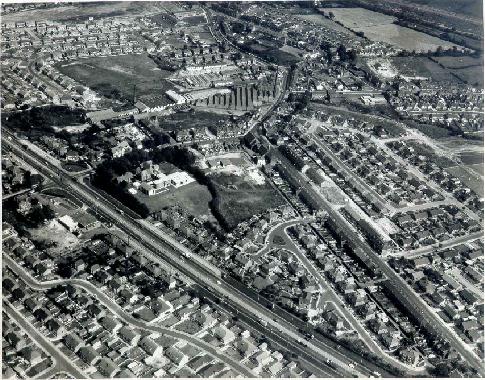
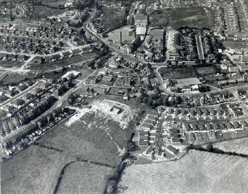
Air photo (below) from around 1972, facing north. Note Yates’s mill, top centre, and St Andrew’s school under construction (just below centre of the photo).
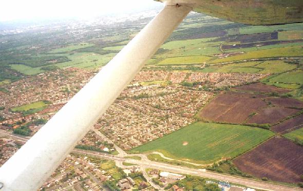
Air photo (below) from around 2000, facing south-east. This gives a good overview of the whole of Boothstown village beyond the East Lancashire Road, which runs along the bottom of the photo. The picture gives a good impression of the open land to the south of Boothstown, and shows the Bridgewater Canal running horizontally, about two-thirds of the way down the photograph. Running from the Queen’s Island on the East Lancashire Road into the green field is the new access road that has been built as a site access road for new house building but may also serve a proposed Forest Park and racecourse south of the canal.